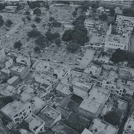
RPAS Aerial Solutions enables organisations and public authorities to leverage drone technology for safer, faster, and more informed public-safety operations. Our UAV pilot training equips operators with the technical knowledge, flight skills, and operational understanding required to conduct safe and effective aerial missions in complex environments.
Drones provide authorities with a real-time aerial perspective that can significantly improve situational awareness, response coordination, and decision-making. From monitoring large gatherings and managing traffic to supporting disaster response and emergency operations, UAVs can provide critical information without putting personnel in potentially hazardous situations.
Our training focuses on responsible and efficient drone operations, helping pilots understand how to plan missions, capture actionable aerial intelligence, operate safely in urban environments, and support ground teams and command centres during routine and emergency situations.
Pillars of Public Safety
▪️Crowd Management ▪️Traffic Management ▪️Disaster Management & Emergency Response
Drones in Crowd Management
- Search & Surveillance: Rapidly scan large areas and provide aerial visibility during search and surveillance operations.
- Crowd Management: Monitor crowd movement, density and congestion to support safer event management.
- Traffic Management: Track traffic flow, identify incidents and support faster response to road disruptions.
- Disaster Management: Quickly assess affected areas, damage and accessibility to support emergency response.
- Emergency Response: Provide real-time aerial intelligence to help teams assess situations and respond effectively.
- Fire & Rescue: Use aerial and thermal imagery to locate hotspots, assess fire zones and support rescue teams.
- Infrastructure Assessment: Rapidly inspect damaged buildings, bridges, roads and other critical infrastructure.
- Situational Awareness: Give command teams a real-time aerial view for faster and better-informed decisions.
- Post-Incident Assessment: Capture detailed aerial imagery and mapping to document damage and support recovery planning.